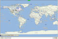
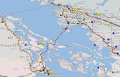
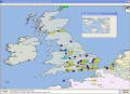
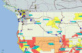
PMapServer7 Screenshots

PMapServer7 was released on Jan 7 2005 at about 5 pm Pacific time. These images were captured from a machine running UI-View32 v2.03 with Precision Mapping 7 installed (officially Precision Mapping Streets & Traveler v7 from UnderTow Software) and PMapServer7 beta. Here are a few samples of it in action. The screenshots of UI-View32 were grabbed with IrfanView and saved with a bit of compression, and the captured maps are from "capture map" in the UI-View file menu. Click on the thumbnails to view the images. Unless you have a very high resolution screen, there will be some horizontal and vertical scrolling. Some browsers will resize images to fit the screen. To see them at their highest resolution, view them full size. When viewing the "large" images, just click on the picture (or use the back button) to return to this page.
 
  • Screenshot of the world with symbols removed.
    (103 KB JPG 1392 x 947 pixels)
PMapServer7 running in UI-View32 - Map of the World
  • Captured map of Victoria & Vancouver BC area, and the northwest corner of Washington State.
    (156 KB PNG 1376 x 891 pixels)
Vancouver BC, Victoria BC, San Juan Islands and Washington State.
  • Screenshot of the UK... sorry, no roads!
    (130 KB JPG 1390 x 1010 pixels)
Screenshot of the UK using UI-View32, PMapServer7 and Precision Mapping 7
  • Captured map of Northwest USA / Southwest BC Canada with UI-NWS running. The shape files in the US portion of the map show severe weather warnings (winter storm, winter weather, wind, etc.) on the map.
    (79 KB PNG 1376 x 891 pixels)
NW USA, SW BC Canada. PMapServer7 in UI-View32. Map by Precision Mapping 7 from UnderTow Software.
  • NWSGet - Seattle-Tacoma Radar image with map symbols (stations) hidden. UI-NWS is also running. Displayed in PMapServer7.05 in UI-View32. This image was captured using UI-View's own "file - capture map".
    (150 KB PNG 1400 x 1050 pixels)
Radar Image of Seattle-Tacoma area obtained from NWSGet. Running PMapServer7.05.


[ Home ]